
Much that happens in “The Java Gold” and many of the posts on this blog relate to places in South-East Asia and the former Netherlands East Indies. I noticed that many of my readers sometimes have a hard time to find those places and areas on current day maps. I therefore include this general overview map of the former Netherlands east indies; it gives a feeling for the incredibly vast area (over 4000 miles from west to east…) that was governed by the Dutch until 1949.
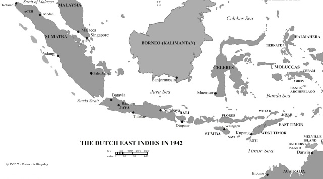
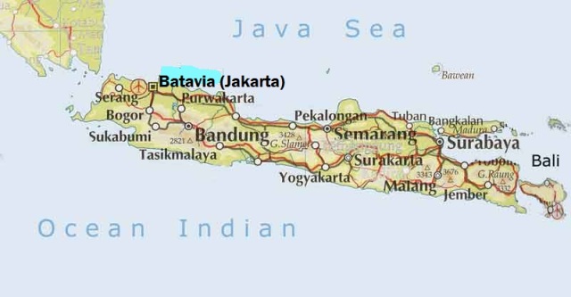
The island of Java held the seat of government and main administrative centres; it was (and is) an island of incredible natural beauty, with bustling large cities and small villages, mountains and rice-fields, volcanoes and rivers. Here’s the map.
US Fighter and Bomber Bases in Java

Source: “They fought with what they had…”
